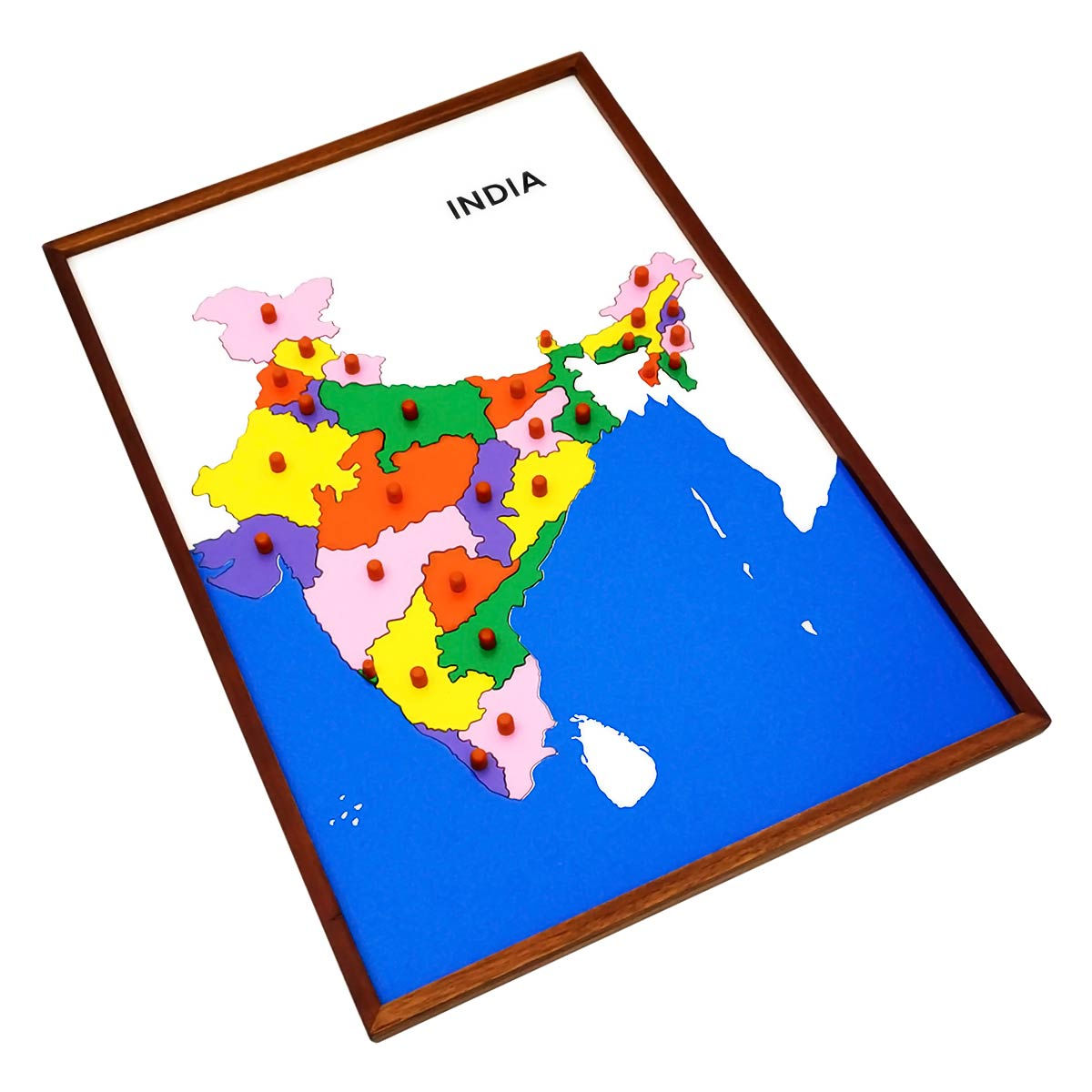
This Montessori Geography Puzzle Map of India is a meticulously crafted educational tool designed to help children learn about the states of India in a fun and interactive way. Below is a detailed description of the product, its features, and the benefits it offers:
Map Puzzle: India
• Elegant Craftsmanship: The map is made from MDF (Medium-Density Fiberboard) and framed with high-quality teakwood, which gives it a refined look while ensuring durability. The sturdy teakwood frame adds an aesthetic appeal that will last for years. • Precise Coin Cutouts: The individual state pieces (coins) are cut with accuracy so that they fit together perfectly, making the puzzle easy to use and visually satisfying. The pieces can be easily removed and placed back on the map, offering an interactive learning experience. • Color-Coding for Clarity: The map uses a color-coded system to distinguish each state of India, with different colors representing the individual states and the blue part of the map representing the oceans. This helps children visually connect the states' positions within the country. • Control Card: A worded control card is included, the same size as the map. This card contains the names of all the states, allowing children to match the pieces with the corresponding labels, reinforcing their knowledge of India's geography.
1. Educational Tool: o This puzzle helps children learn the names, positions, and sizes of the various states of India in a fun and engaging manner. It is a great way to introduce geographical concepts and improve spatial awareness. 2. Develops Logical Thinking: o As children assemble the puzzle, they use logical thought and reasoning to match each state with its correct position on the map. This fosters critical thinking and problem-solving skills. 3. Geographical Knowledge: o The map helps children understand the layout of India and learn about the locations of its states. By using the control card, children can match the state names with their geographical locations, enhancing their overall understanding of India's geography. 4. Fine Motor Skills Development: o Handling the puzzle pieces and placing them on the map helps children develop fine motor skills and hand-eye coordination, which are essential for their physical development. 5. Montessori Method: o The map follows the Montessori color-coding system, which is a universal method used to teach geography. This helps children learn in a visually stimulating way and makes it easier to understand complex geographical concepts.
• Quality Materials: The puzzle is made from MDF, a durable material, with a beautifully handcrafted teakwood frame that adds sophistication and strength to the map. • Precision Crafting: The state pieces (coins) are cut with precision to ensure they fit seamlessly into the map, making the puzzle easy to use and ensuring a high-quality learning experience. • Expert Artisans: The puzzle is created by a team of professional craftsmen who have over 8 years of experience in creating premium educational toys. Their attention to detail ensures that the puzzle meets high standards of quality and craftsmanship.
• Home Learning: Perfect for children learning about India's geography at home, allowing for self-directed learning and exploration. • Classroom Use: A great educational tool for teachers to use in geography lessons to help children visualize and understand India's state layout. • Gifts: This puzzle makes an excellent gift for children interested in geography, or for parents who want to foster their child's learning about India's states. This India States Puzzle Map is a wonderful educational resource that encourages children to explore and understand the geography of India in a fun and hands-on way. The color-coded map, precision-cut pieces, and worded control card make it a perfect tool for developing spatial awareness, logical thinking, and geographical knowledge. Its craftsmanship and Montessori-based design make it a valuable addition to any child's learning collection.